Property Record
2905 Lamar Ave, Memphis, TN 38114


Current Lease Availabilities
NEARBY LISTINGS FOR SALE OR LEASE
Property Detail
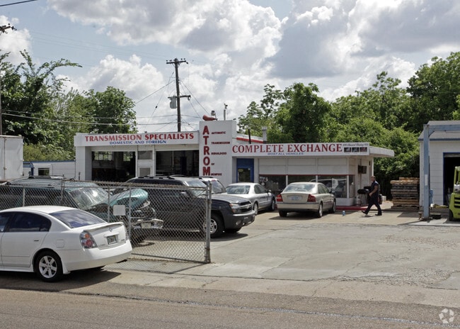
2905 Lamar Ave
05-9021-0-0003
Fairlawn
Autorepair
Shelby
X
Tennessee
47157C0430F
0.38 AC
2024
Downtown/Midtown
2025
Memphis
008120
Memphis, TN-MS-AR
2,266 SF
DEMOGRAPHICS near 2905 Lamar Ave
1 Mile
3 Mile
5 Mile
2024 Total Population
12,224
83,878
229,711
2029 Population
12,306
84,329
229,740
Pop Growth 2024-2029
+ 0.67%
+ 0.54%
+ 0.01%
Average Age
40
38
38
2024 Total Households
5,063
34,659
95,689
HH Growth 2024-2029
+ 0.47%
+ 0.41%
(0.11%)
Median Household Inc
$30,023
$36,924
$41,810
Avg Household Size
2.30
2.30
2.30
2024 Avg HH Vehicles
1.00
1.00
1.00
Median Home Value
$62,492
$91,491
$159,089
Median Year Built
1955
1956
1958
Nearby Places
Map Layers
Map Styles
 Street
 Aerial
- Restaurants
- Banks
- Shops
- Fitness
- Groceries
PUBLIC TRANSPORTATION
COMMUTER RAIL
Central Station (Riverfront Loop - Memphis Area Transit Authority Trolley (MataTrolley))
DRIVE
WALK
Distance
Central Station (Riverfront Loop - Memphis Area Transit Authority Trolley (MataTrolley))
11 min
6.9 mi
AIRPORT
Memphis International
DRIVE
WALK
Distance
Memphis International
7 min
4.7 mi
Freight Ports
Port of Shreveport
DRIVE
WALK
Distance
Port of Shreveport
407 min
374.4 mi
Nearby Properties
Address
Land Use
TOTAL SIZE
Lot Size
Zoning
Address
Land Use
TOTAL SIZE
Lot Size
Zoning
286,167 SF
18.91 AC
R-10
Address
Land Use
TOTAL SIZE
Lot Size
Zoning
190,263 SF
6.59 AC
R-10
Address
Land Use
TOTAL SIZE
Lot Size
Zoning
118,073 SF
4.75 AC
CMU-1
Address
Land Use
TOTAL SIZE
Lot Size
Zoning
2,847.82 AC
EMP
Address
Land Use
TOTAL SIZE
Lot Size
Zoning
188,458 SF
29.19 AC
RU-3
Address
Land Use
TOTAL SIZE
Lot Size
Zoning
1,760,826 SF
109.47 AC
EMP
Address
Land Use
TOTAL SIZE
Lot Size
Zoning
87,283 SF
2.14 AC
CMU-1
Address
Land Use
TOTAL SIZE
Lot Size
Zoning
81,454 SF
EMP
Address
Land Use
TOTAL SIZE
Lot Size
Zoning
69,204 SF
4.54 AC
CMU-3
Address
Land Use
TOTAL SIZE
Lot Size
Zoning
509,111 SF
EMP
Address
Land Use
TOTAL SIZE
Lot Size
Zoning
342,605 SF
82.99 AC
CA
Address
Land Use
TOTAL SIZE
Lot Size
Zoning
190,456 SF
13.71 AC
CMU-1
Address
Land Use
TOTAL SIZE
Lot Size
Zoning
1,117,337 SF
127.15 AC
EMP
Address
Land Use
TOTAL SIZE
Lot Size
Zoning
55,250 SF
7.15 AC
CMU-3
Address
Land Use
TOTAL SIZE
Lot Size
Zoning
129 AC
CMP-1
Address
Land Use
TOTAL SIZE
Lot Size
Zoning
369,190 SF
23.75 AC
EMP
Address
Land Use
TOTAL SIZE
Lot Size
Zoning
300,011 SF
17.53 AC
EMP
Address
Land Use
TOTAL SIZE
Lot Size
Zoning
173,089 SF
10.92 AC
EMP
Address
Land Use
TOTAL SIZE
Lot Size
Zoning
81,516 SF
2.76 AC
RU-3
Address
Land Use
TOTAL SIZE
Lot Size
Zoning
71,308 SF
EMP
Address
Land Use
TOTAL SIZE
Lot Size
Zoning
66,841 SF
7.86 AC
CMU-3
Address
Land Use
TOTAL SIZE
Lot Size
Zoning
81,958 SF
0.98 AC
CMU-1
Address
Land Use
TOTAL SIZE
Lot Size
Zoning
62,022 SF
6.28 AC
EMP
Address
Land Use
TOTAL SIZE
Lot Size
Zoning
42,102 SF
18.74 AC
RU-3
Address
Land Use
TOTAL SIZE
Lot Size
Zoning
73,168 SF
1.38 AC
CMU-1
Address
Land Use
TOTAL SIZE
Lot Size
Zoning
191,168 SF
4.56 AC
CMP-1
Address
Land Use
TOTAL SIZE
Lot Size
Zoning
306,219 SF
12.11 AC
EMP
Address
Land Use
TOTAL SIZE
Lot Size
Zoning
209,257 SF
39.71 AC
EMP
Address
Land Use
TOTAL SIZE
Lot Size
Zoning
7,632 SF
40.80 AC
EMP
Address
Land Use
TOTAL SIZE
Lot Size
Zoning
64,990 SF
7.34 AC
RU-3
The World's #1 Commercial Real Estate Marketplace
Connect with us
© 2025 CoStar Group
The information above has been obtained from sources believed reliable. While we do not doubt its accuracy we have not verified it and make no guarantee, warranty or representation about it. It is your responsibility to independently confirm its accuracy and completeness. Any projections, opinions, assumptions, or estimates used are for example only and do not represent the current or future performance of the property. The value of this transaction to you depends on tax and other factors which should be evaluated by your tax, financial, and legal advisors. You and your advisors should conduct a careful, independent investigation of the property to determine to your satisfaction the suitability of the property for your needs.